
The following comparative overview of the extents of the “orthodox” and “nonorthodox” forms of Christianity from the time of the fall of Jerusalem through the second century is taken from chapter 8 of Walter Bauer‘s Orthodoxy and Heresy in Earliest Christianity. His information is inferred from the surviving literature from this period, and later references to literature no longer surviving.
No doubt there are studies since Bauer that would alter the overview and map below.
It is easy to imagine that the Christian religion we know grew steadily from Palestine and expanded gradually outwards, firstly through Syria, Asia Minor and Greece, until it gradually blanketed the whole Mediterranean world and Middle East.
But if that was the way it happened then how can the following extent of “nonorthodox” forms of Christianity be explained?
(click on map to enlarge it)
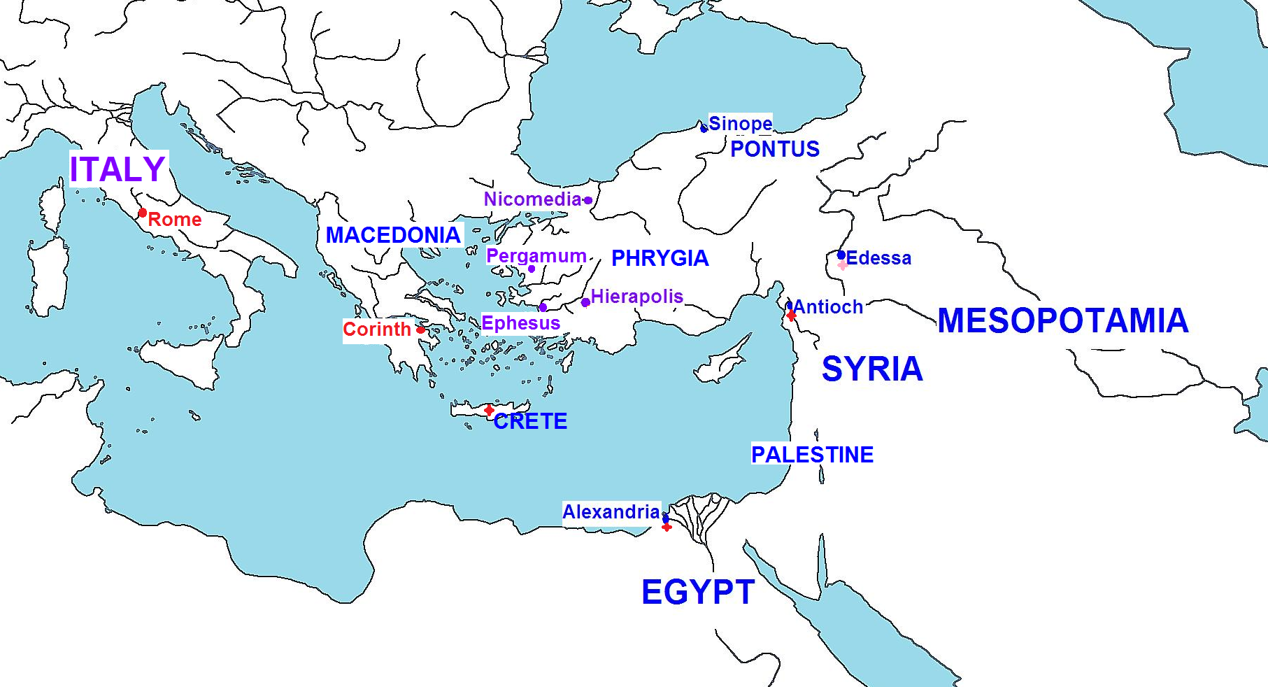
Blue = “non-orthodox” (e.g. Marcionites, Valentinians, and other such “gnostic” types)
Red = Roman-orthodox strongholds
Purple = contested areas; where “orthodoxy” was struggling, often in some form of “rear-guard” action, against the “non-orthodox”
Red stars = minority presence of “orthodoxy” (Edessa is a special case: the “orthodox” were also described as “gnostics”)
“Orthodox” strongholds and outposts
At the turn of the century, around 100 c.e., there were evidently only two major bastions of what we might call the foundations of the orthodox Christianity that we would recognize today: Continue reading “Map of second century Christianities”